Venue Category: Parks

  • Blyth Park

    Blyth Park

    Blyth Park in Bothell, Washington, has these features:

    • Large Picnic Shelter
    • Small Picnic Shelter
    • Play Area
    • Restrooms
    • Picnic Tables
    • BBQ
    • 10-Hole Disc Golf
    • River Views
    • Trail connection to the Burke Gilman and Sammamish River Trails
    • Walking access to Former Wayne Golf Course
    • Parking Lot

    Bothell services 400 acres of parkland, 265 acres of open space, and 135 acres of active parklands. Bothell’s park system includes 26 parks, and over 3.6 miles of regional trails. 

  • Cedar Grove Park

    Cedar Grove Park

    Features

    • Large picnic shelter (capacity 60)
    • Restrooms
    • BBQ and grill
    • Picnic tables
    • Children’s playground
    • Basketball court
    • Sports field
    • Wetland boardwalk
    • Parking lot spaces
    • Acres: 13.75
  • Kenmore Town Square

    Kenmore Town Square

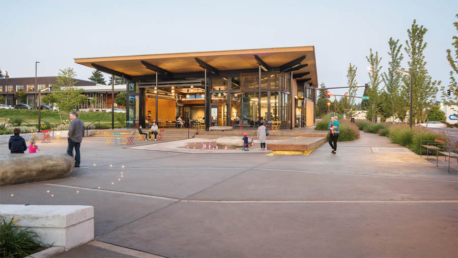
    The Town Square and Hangar are now open! Located at 6728 NE 181st Street, the mission of the Town Square and Hangar is to mold signature downtown public spaces where Kenmore area residents, visitors, and business people can gather, interact, meet some of their daily needs, and have an authentic local sense of place. By achieving this mission, the Town Square and Hangar will build a sense of community and can serve to catalyze economic vitality and investment in Kenmore’s downtown.

    What is the Town Square?

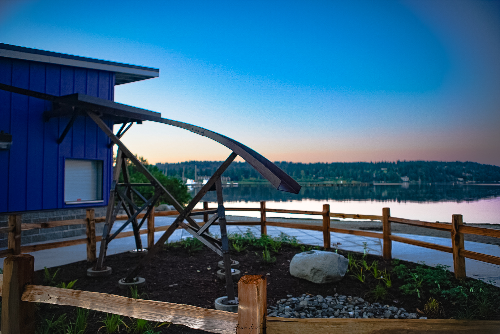
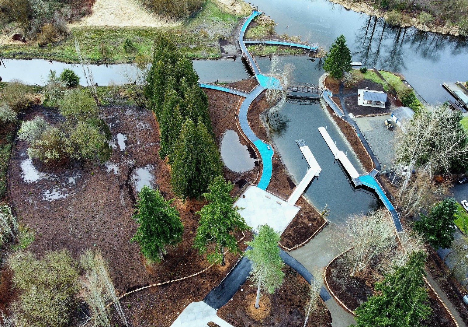
    Connected to the Hangar by a large airplane hangar-style door that can remain open on warm summer days, the Town Square is an outdoor gathering space that features a “dock” to sit on and dangle feet in water fed by fountains interwoven with lights. Bike racks and a bike maintenance station providing air and tools for minor repairs, and a bike charging station for electric bicycles provide support for this modality. During cooler months the Town Square offers unique heated rocks—realistic giant rocks heated with radiant heat to provide a warm respite from chilly air. Backyard-style seating areas in casual groupings provide an additional option for lingering. Complete with a doggie station and bag dispenser to accommodate those with leashed dogs, and other surprises waiting to be discovered, the Town Square offers 12,750 square feet of companion space to the Hangar, a perfect setting for community interaction.

    What is the Hangar?

    Designed to accommodate community gatherings and shared use, the Hangar features a double-sided fireplace and eclectic array of comfortable furniture creating a warm and intimate space to read, converse, work on homework or simply hang out. This 1,985-square-foot common area “Otter” has free Wi-Fi, a variety of outlets including phone and computer charging stations, a projector and screen and a robust audio-visual system, all contributing to a contemporary, technology-enabled space. Adjacent to the main space is a 208-square-foot multi-purpose room “Beaver” with glass sliding doors set in the open position when the room is not in use. This public space contains a flat-screen television and is available for reservations.

    Co-located within the Hangar is retail tenant Diva Espresso, a northwest original coffee franchise that roasts its own beans at its warehouse in north Seattle. Diva Espresso will sell various beverage and food options, including coffee drinks, teas, smoothies, baked goods, sandwiches, ice cream, and beer and wine for on-premises consumption. The Hangar allows visitors to take advantage of the offerings of Diva Espresso or just hang out in a community “living room” that is free and accessible to all.

    The Hangar is open 6:00 am to 5:00 pm on Monday through Saturday, and 7:00 am to 5:00 pm on Sunday.

  • Pfingst Animal Acres Park in Lake Forest Park

    Pfingst Animal Acres Park in Lake Forest Park

    Nearly four acres of maintained meadow and tall, arching shade trees at Pfingst Animal Acres Park provide a lovely area for picnics or a nature walk. At the south edge of the park, McAleer Creek winds through a forested corridor with a good salmon viewing platform. This platform is used by local schools for annual salmon release events.

    The park also features a Master Gardener Demonstration Garden, produce grown and harvested goes to a local food banks. A crushed gravel walking trail that loops the perimeter of the park. Amenities include a metal dogwood flower drinking fountain featuring a special drinking spout for dogs and a Mother with Otter Pup sculpture donated by the Lake Forest Park Garden Club.

  • Tracy Owen Station (Log Boom Park)

    Tracy Owen Station (Log Boom Park)

    Amenities:

    • Accessible pathways
    • Beach
    • Boat rental building
    • Fishing
    • Lake access
    • Launching facilities for hand carry watercraft
    • Parking lot
    • Picnic benches
    • Picnic shelter (first come, first served)
    • Picnic tables
    • Playground
    • Public restrooms
    • Sitting boulders
    • Walking paths
    • Watercraft wash down station
    • Wetlands
    • Wooded areas
    • Public artworks including the signature “Flume” sculpture by Jennifer Dixon

    This 3.9-acre park provides access to over 1200 lineal feet of shoreline on Kenmore’s Lake Washington waterfront. The public dock is a fantastic place to watch the seaplanes land, toss out a line for fishing or simply enjoy the sunset. Other features include the Kenmore History Path, playground area, picnic tables, access to the Burke-Gilman Trail, daytime moorage, and restroom facility. The park was renamed Tracy Owen Station after the late King County Councilmember, Tracy Owen.

  • ƛ̕ax̌ʷadis (Tl’awh-ah-dees) Park

    ƛ̕ax̌ʷadis (Tl’awh-ah-dees) Park

    In April of 2021, Kenmore City Council passed a unanimous motion to change the name of Squire’s Landing Park to ƛ̕ax̌ʷadis  (Tl’awh-ah-dees), the name of the Lushootseed village previously located in or near present-day downtown Kenmore. ƛ̕ax̌ʷadis  translates to “a place where something is grown or sprouts” and honors the Coast Salish People who originally inhabited the area, and the many Indigenous Peoples who still reside here.

    • ƛ̕ax̌ʷ – these characters roughly translate to “grow”
    • adis – these characters roughly translate to “brushy area”

    Select the arrow to hear how ƛ̕ax̌ʷadis is said.

    Amenities at the park

    This park has the following:

    • Accessible pathways
    • Launching facilities for hand carry watercraft
    • Parking lot
    • Pedestrian bridges
    • Picnic benches
    • Picnic shelter (first come, first served)
    • Picnic tables
    • Public restrooms
    • Viewing decks
    • Walking paths
    • Watercraft wash down station
    • Wetlands
    • Wooded areas
  • Dash Point State Park, Federal Way, Washington

    Dash Point State Park, Federal Way, Washington

    Washington water fans, look no further! Bust out your kayak, sand bucket, swimsuit or fishing rod, and head straight for Dash Point State Park!

    Hidden in plain sight between Seattle and Tacoma, this park offers miles of forested hiking and biking trails, but its main draw is the beach. The shoreline narrows at high tide, bringing anglers out to its pier. Low tide turns the sand flats into a play destination for locals, families with children and hip skim boarders surfing the shallow water.

    Dash Point has become a hotspot for skim boarding, which consists of throwing a small, thin board into shallow water, jumping onto it and riding it like a cross between a surf board and a skateboard. Low tide at Dash Point provides ideal conditions for this activity, and this is a popular place for skim boarding camps, competitions and gatherings on the park’s sandy shores.

    While boarders chase the ultimate ride, birders can see a multitude of shore birds and raptors. Beach explorers will find starfish and crabs. Budding botanists can identify a rich variety of trees, plants and flowers.

    Whether you’re out for an afternoon or a camping trip, whether you’re watching your kids, the birds or the boarders, you’ll be delighted by this oasis tucked between two urban hubs.

  • Rainbow Falls State Park, Chehalis, Washington

    Rainbow Falls State Park, Chehalis, Washington

    A rare cluster of old-growth trees creates an inspiring shadow to stand in. Rainbow Falls State Park, 16 miles west of Chehalis, is a walker’s paradise. Miles of loamy trails wind through the forest and along the river, to a small cascade that throws rainbows of spray at the sun.

    Tree lovers, maybe you’d rather see towering Douglas-fir, western hemlock and western red cedar trees from your bike or the back of your steed. Many of the park trails are mixed-use, and if you need more, take to the nearby Willapa Hills State Park Trail, a rails-to-trails fixture that goes over trestles and bridges, through forest, farmland and tiny towns.

    Rainbow Falls is the obvious overnight stop for hikers, cyclists and horseback riders tackling the developed 22 miles of Willapa Hills Trail from Chehalis to Pe El. Such explorers may stay at hiker/biker campsites, or camp with their horses in one of two equestrian sites.

    Built by the Civilian Conservation Corps in 1935, Rainbow Falls showcases several structures designed in the rustic style of the National Park Service during the Great Depression, including kitchen shelters and comfort stations still in use today.

  • Deception Pass State Park, Oak Harbor, Washington

    Deception Pass State Park, Oak Harbor, Washington

    Deception Pass is Washington’s most-visited state park for a reason. Mysterious coves, rugged cliffs, jaw-dropping sunsets, and a stomach-dropping high bridge make this park a go-to for locals and international travelers alike.

    Attend an interpretive program to learn about the park’s cultural and natural history. Check out the Washington State Park – Calendar for the full list of programs.

    Deception Pass State Park spreads over 3,854 acres, a marine and camping park with 77,000 feet of saltwater shoreline and 33,900 feet of freshwater shoreline on three lakes. The park is actually located on two islands — Fidalgo to the north and Whidbey to the south. The Canoe Pass and Deception Pass bridges connect the two islands, creating a gateway for exploration.

    Kukutali Preserve on Kiket Island is the newest state park property at Deception Pass. Co-owned and co-managed by the Swinomish Indian Tribal Community and Washington State Parks, this area welcomes visitors to bask in its old-growth forest, which ends at stunning views of Fidalgo, Hope, and Skagit islands. Flagstaff Point beyond a neck of land is off-limits to people, to protect a rare environment called a “rocky bald,” which supports fragile native plant communities. Pets are not allowed in any area of the preserve.

  • Beaver Falls, Clatskanie, Oregon

    Beaver Falls, Clatskanie, Oregon

    Trailhead directions

    Everett, Seattle, Tacoma, Olympia, and Chehalis

    Follow I-5 S to Exit 36 A&B, WA-432 West. On the exit ramp, take Exit 36B, WA-432 West to Longview. Stay on WA-432 West when it exits to 3rd Avenue. Turn left on WA-432, 3rd Avenue, to the Port of Longview. Stay on WA-432 when it turns right from 3rd Avenue to Industrial Way. Continue on WA-432 to turn left on WA-433, Oregon Way. Cross the Columbia River on the Lewis and Clark Bridge.

    After crossing the Columbia River, Turn right on the first exit to US-30 W and continue for 4.8 miles to Beaver Falls Rd in Columbia County, Oregon. Drive 3.6 miles up Beaver Falls Road and pull into the large dirt turnout on the left, just past the start of Beaver Falls Trail.

    Portland

    Take US Route 30 northwest for 52 miles to Beaver Falls Road. The right turn onto Beaver Falls Road comes 4.8 miles past the interchange with Washington Route 433 across the Columbia River from Longview, Washington. Drive 3.6 miles up Beaver Falls Road and pull into the large dirt turnout on the left, just past the start of Beaver Falls Trail.

    Astoria

    Drive east on US Route 30 for 34 miles to the town of Clatskanie. Turn left onto North Nehalem Street. Drive a couple blocks to an awkward intersection and turn onto the second street on the left, which is NW 5th Street. Drive 6 miles from here to the trailhead, which will be on the right. 5th Street becomes Beaver Falls Road after half a mile.

Participants in the pageant on Sunday, January 4, 2025, should be present by 9:30 am. 

1st Sunday in Lent (Year A), February 22, 2026. Services at 8:00 am (no music) and 10:30 (music). Christian education for children and adults at 9:15 am. 

Episcopal Church of the Redeemer
Privacy Overview

Cookie information is stored in your browser and performs functions such as recognizing you when you return to our website and helping our team to understand which pages of the website are visited. We aren't using cookies to determine your web browsing habits, but others can.